
Understanding Drone Thermal Imaging
- paulrobc
- Jun 3, 2024
- 2 min read

Drone Thermal Imaging: Unveiling the Invisible Heat
Introduction
Drone thermal imaging is a cutting-edge technology that combines the versatility of drones with the ability to detect and capture infrared radiation. Unlike traditional cameras that rely on visible light, thermal drones reveal the hidden world of heat emissions. In this educational piece, we’ll explore how thermal imaging works, its applications, and the importance it holds across various industries.
How Does It Work?
Infrared Sensors and Heat Detection:
At the heart of a thermal drone camera lies a sophisticated sensor tuned to detect infrared radiation. This invisible energy, emitted by all objects, is felt as heat but remains unseen to the naked eye.
The sensor captures this radiation in the range of 1 to 14 micrometers on the electromagnetic spectrum.
When a thermal drone flies over an area, the sensor records temperature variations, creating a heat map where warmer objects stand out against cooler backgrounds.
Applications of Thermal Drones:
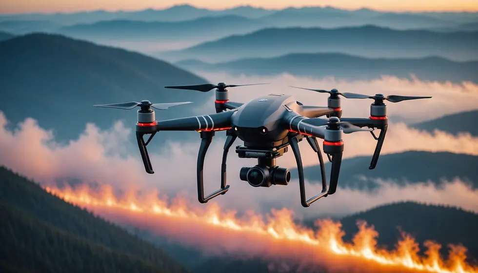
During wildfires, thermal drones provide invaluable assistance to firefighters. They can penetrate thick smoke and identify hotspots, guiding ground teams to strategic locations.
In search and rescue missions, these drones help locate missing persons by detecting body heat signatures even in challenging environments.
Oil refineries and industrial plants use thermal drones to assess equipment health without endangering human lives.
Power line inspections become efficient as drones detect overheating components or loose connections.
Thermal imaging reveals hidden issues in buildings. It detects heat leaks, insulation problems, and structural abnormalities.
Roof inspections become more accurate, identifying areas with compromised insulation or water damage.
Thermal drones scan solar panels for malfunctioning cells or damaged components.
By identifying underperforming panels, solar farm operators can optimize energy production.
Farmers use thermal drones to monitor crop health. Variations in temperature indicate stress, disease, or irrigation problems.
Precision agriculture benefits from targeted interventions based on thermal data.
During emergencies, thermal drones reveal hidden dangers. They assist law enforcement in crowd monitoring, disaster response, and perimeter surveillance.
Conclusion
Drone thermal imaging provides a fresh perspective by detecting variations in temperature. Whether it’s aiding firefighters, inspecting power lines, or assessing crop health, these aerial emissaries play a crucial role. So next time you see a drone hovering overhead, remember that it might be revealing the invisible heat that surrounds us all.
I hope you find this educational piece informative! If you have any further questions or need additional details, feel free to ask.


Comments